![]()
THE ALAN GODFREY MAPS Reprints of Old Ordnance Survey Maps. Almost 3,000 titles, covering most of the UK and parts of Ireland. For most of us interested in Local and family History, they can offer a window on the streets in which our ancestors lived at the turn of the 19th century and sometimes earlier, at a scale of approx 14 inches to the mile (1:2500). For my own convenience I decided to try and index all the streets, churches, some physical features etc. I have included the results on this website and, If you also own some of these maps, you may find it helpful. |
|
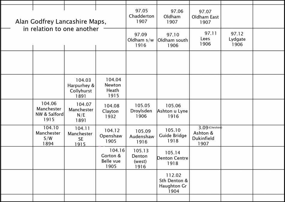
Maps included in the index are shown on this location/layout grid.
|
RETURN to Godfrey Maps Introrduction Page